
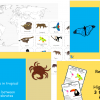
Rainforest Locations Lesson
£3.50
Part of our amazing ten lesson Rainforest Topic, aimed at Lower KS2. Download this lesson or purchase the entire planning bundle for £10 here.
This lesson allows students to locate rainforests around the world and includes:
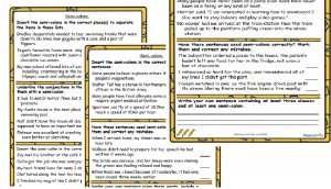
- Clear teaching PPT illustrating where on the map of the world the lines of tropics are, explaining the difference between tropical and temperature rainforests and what they mean.
- Engaging main activity to find and mark tropical rainforests on the map of the world with three levels of differentiation, some will work towards finding both tropical and temperate rainforests and understanding that tropical rainforests lie within the lines of tropics.
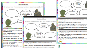
- Continent maps with tropical and temperate rainforests marked on for students to use as reference points when plotting rainforests on their world map.
National Curriculum Objectives:
- Locate the world’s countries, using maps to focus on Europe (including the location of Russia) and North and South America, concentrating on their environmental regions, key physical and human characteristics, countries, and major cities
- Identify the position and significance of latitude, longitude, Equator, Northern Hemisphere, Southern Hemisphere, the Tropics of Cancer and Capricorn, Arctic and Antarctic Circle, the Prime/Greenwich Meridian and time zones (including day and night)
Maps provided by https://freevectormaps.com.
Related products

Grammar
£2.00

Key Stage 2
£8.00

£1.50

Grammar
£1.50

£2.00

Grammar
£2.00


Grammar
£2.00
£1.50